

Alexander the Great, Genghis Khan, Rome, the Ottomans and Saddam Hussein all crossed, raided or bled on the Iranian plateau.
Their stories differ, but the outcome was written by the same hand: a ring of mountains, a difficult coastline and borders that were set not by diplomats but by the limits of what an invader could sustain.
The winter of 330 BC. A mountain pass deep within the Zagros range, near present-day Yasuj. Alexander the Great and his army are moving through a narrow defile known as the “Persian Gates” (Darband-e Pars), aiming to capture Persepolis, the heart of the Achaemenid Empire, and thereby complete his conquests. Until that moment, he had never known defeat, having decisively beaten Darius III in three consecutive battles.
High upon the crags, Persian soldiers lie in wait. As Alexander’s forces enter the pass, the mountains themselves seem to turn on them, as if the very heavens had begun to rain down: a torrent of arrows, spears and stones falls on the Macedonian troops, trapping the most formidable war machine of the ancient world in a gorge so narrow that two men could barely walk side by side.
For the first time in his life, Alexander orders a retreat, leaving behind his wounded and his dead.
History records that Alexander, aided by a treacherous shepherd, eventually outflanked the forces of Ariobarzanes, defeated them and conquered the Persian Empire. But that single instance of defeat was inflicted not by Persian soldiers. It was inflicted by Iran’s own geography.
A fortress at a crossroads
What is the nature of Iran’s geography? Look at a map and you see a territory encircled by rugged mountains, a place exceptionally difficult to penetrate. Yet this land is not a fortress tucked away in some remote corner of the world. It is a stronghold situated at the very center of the globe, at the heart of its most vital crossroads.
Iran’s history is, in essence, the story of these two concepts: a fortress at a crossroads. When discussing Iran’s geography, the question is not simply where the country is located, but what is the nature of that location.
The Iranian plateau is composed of diverse terrain, including mountains, forests and vast deserts. Both its physical landscape and its strategic position explain why Iran has lived such a dramatic history, for geography is the stage upon which history unfolds.
Iran sits at a crossroads historically represented by the Silk Road and today by trade corridors and energy routes. It is a hinge connecting West Asia, Europe, Central Asia, the Caucasus and the Indian subcontinent.
For centuries, this route has carried trade, armies, religions, ideas and knowledge. Whoever controls this crossroads can harness the advantage to generate power and emerge as a significant geopolitical actor.
Yet the same position carries adverse consequences. Some of history’s greatest conquerors have traversed this land. Alexander the Great set out from the West, crossed Iran and advanced toward India. Fifteen centuries later, Genghis Khan set out from the East, passed through the heart of Iran and pushed toward Europe.
Whether moving from East to West or West to East, these figures were compelled to pass through Iran, because anyone seeking to travel from one end of the ancient world to the other had no choice but to cross its territory.
Whether bearing goods or the sword, or both, travelers were inevitably drawn through it.
Even among Iran’s neighbors, there have always been great powers: Rome, Byzantium, the Ottoman Empire, Tsarist Russia, the Soviet Union, Britain from its base in India and, today, the United States, with its military bases surrounding Iran.
A wall of nested mountains
The borders of the Iranian plateau are largely natural, a feature absent in other countries across West Asia. Iran’s boundaries were not simply drawn with a ruler. Even from space, it is evident that this land is distinct from its surroundings.
A prime example is the Zagros Mountains: a 1,600-kilometer-long barrier of successive, interlocking ranges. An army trying to enter Iran from the west would not face a single wall, but a series of nested, overlapping barriers.
The distance from Bushehr to Shiraz may look like 200 kilometers on a map, but the reality is far more complex. An invading force would have to move from the coast to the plains, ascend into the mountains, traverse narrow passes to reach another plain, cross that plain and navigate further passes before finally arriving in Shiraz, a city 1,500 meters higher than Bushehr.
Each pass and plain along this route has its own climate and its own local population, and any one of them could become a focal point of resistance.
Seizing this relatively short route is not a single task but a series of distinct, arduous challenges, and holding it is harder still. Within this compact stretch of Iranian territory, each pocket of resistance has the potential to inflict irreparable losses on an invading army.
No Normandy on the Persian Gulf
It would be a mistake to imagine that Iran’s defensive capability begins and ends with the Zagros and Alborz. The country’s entire southern coastline, running from the Persian Gulf through the Gulf of Oman, functions as a single, unified line of defense, backed by a mountainous coastal belt that rises almost directly out of the sea.
Until a few centuries ago, even the Persian Gulf itself was a natural barrier, in a time before ships had the technology to carry invading forces thousands of kilometers to these shores. Today, a force that reaches the coast and lands troops will still find mountains just a few kilometers inland. The beaches along Iran’s southern shore are narrow and end in steep escarpments and mountain ridges near the water’s edge.
This is nothing like Normandy, where the beaches are wide, gently sloping and open onto an expansive plain, ideal ground for advancing and seizing territory.
A landing modeled on Normandy would not work in Iran. Any amphibious force that established a beachhead would find itself pinned between the sea and the mountains, unable to move further inland. The contrast with Iraq is instructive. Iraq’s flat terrain made the swift armored thrust of 2003 possible. Iran offers no such ground.
The limits of ambition
The same plateau and geography that have shielded Iran from persistent foreign invasion have also, over the centuries, constrained the ambitions of its own rulers. The pattern of Iran’s territorial expansion throughout history has been remarkably consistent.
At its greatest natural extent, Iran’s geopolitical reach has stretched eastward to the Hindu Kush, southwestward to Cairo and the banks of the Nile, and northwestward to the Dardanelles and the Bosphorus.
The sole historical exception was the Achaemenid Empire, which extended beyond these limits to the shores of the Black Sea, though upon arriving there it became bogged down and could advance no further. However, this geography contains two significant gaps that have remained open throughout history.
The first gateway: The Khorasan Corridor
The first is the northeastern passage, the Khorasan Corridor: a series of natural valleys spanning several hundred kilometers that linked Nishapur to Merv. This is the route through which, in ancient times, some of the Indo-European peoples entered the Iranian plateau.
The Silk Road also passed through this corridor, leaving an economic imprint clearly visible in cities such as Merv, Nishapur, Samarkand and Bukhara.
Yet just as geography offers rewards, it also exacts a price. Beyond the Khorasan Corridor lie the Karakum Desert and the steppes, vast, flat expanses stretching from Mongolia to Hungary, long inhabited by nomadic, horse-riding peoples.
While the corridor served as a conduit for trade, it also functioned as a gateway for the raids of these tribes. Iran’s history is full of eras marked by incursions from the steppes onto the plateau. Time and again new peoples emerged from the steppes and crashed against this gateway like a tidal wave. The names change, but the nature of the corridor has remained constant; the actors shift, yet the underlying trajectory persists.
The Scythians gave way to the Hephthalites, who were in turn succeeded by the Oghuz, though the latter’s arrival was of a different order. Toghrul the Seljuk did not come merely to plunder and depart. He came to stay.
He established the Seljuk dynasty in Iran, and for the first time since the advent of Islam, the territorial extent of Iran came to encompass the entire geographical plateau.
Centuries later, an even more devastating deluge struck the corridor. Genghis Khan and his Mongol army, having laid waste to Merv, surged through this passage onto the plateau and ushered in the darkest chapter in the region’s history.
Most of the large and prosperous cities of Khorasan either vanished from the map, like Merv, or never regained their former prosperity, like Nishapur.
Once again, through this very gateway, came Timur and the Uzbeks. The gateway remained open until the Safavid era, when Shah Abbas the Great defeated the Uzbek army within the corridor. After that, no major invasion of the plateau came by this route, although until the nineteenth century Turkmen tribes would occasionally emerge from it to raid.
The threat of sudden incursions eventually ceased, but not through the construction of walls. It ceased through a change in neighbors. In the mid-nineteenth century, Tsarist Russia arrived and brought the local khanates to their knees. Beyond this gateway there were no longer nomadic tribes but an industrial empire equipped with railways and the telegraph.
The corridor was finally “closed” by treaties, most notably the Treaty of Akhal, which established the Atrek River as the border between Iran and the Russian Empire.

The second gateway: The northwestern wall
Now turn to the second gateway of the “fortress.” On Iran’s western frontier, the northwest forms a mountainous nexus where three ranges, the Zagros, the Caucasus and the Anatolian mountains, converge.
The result is a high plateau of harsh, prolonged winters and two landlocked natural lakes. This is not an open plain suitable for military maneuver. It is a rugged, fragmented landscape in which every valley can be turned into a defensive front. An army trying to enter Iran from the west has only one viable route: a corridor in the lower section of the map.
Throughout seven centuries of conflict between Iran and Rome, Ctesiphon fell repeatedly, and six Roman emperors reached the Iranian capital. Yet none of them was able to conquer the Iranian plateau.
Ctesiphon, the capital, stood near present-day Baghdad on the Mesopotamian plain, but the plateau lay behind a “wall,” a formidable natural barrier that no opposing force could breach. The pattern persisted for the next thousand years. The actors changed, but the underlying dynamic did not.
Even when the Ottoman Sultan Selim, relying on the superior power of his artillery, defeated the Iranian forces of Shah Ismail Safavid at Chaldiran and captured Tabriz, he was eventually forced to withdraw from the plateau. His logistical and supply lines had to cross the Zagros “wall,” a task of immense difficulty.
The Ottoman sultans took Tabriz on several occasions, but Shah Abbas the Safavid moved the capital from Tabriz to Isfahan. That made it impossible for the Ottomans to seize the Iranian capital, since doing so would have stretched their supply lines from Istanbul too thin, deep into the plateau.
A wall that cuts both ways
This “wall” acts as a barrier for both sides. Iran, too, repeatedly tried to advance westward, and either failed to make headway or could not hold what it won. This was true of Khosrow Parviz, who advanced to the very walls of Constantinople, and of Shah Abbas and Nader Shah, both of whom captured Baghdad only to be forced, after some time, to fall back behind the plateau.
Agreements such as the Treaty of Amasya, the Treaty of Qasr-e Shirin and the Treaty of Zuhab thus became effective frameworks for Iran’s western border. For the past four hundred years, that border has remained exactly where it is today.
This was not because the parties were inclined toward peace, for they were not, but because they could no longer advance. Iran and the Ottoman Empire had reached a stalemate.
Borders drawn by geography
Across the Levant and western Iran, most borders were drawn by diplomats under colonial-era treaties, and many of them were decided by the colonial powers that created those states. The border between Iran and Iraq, however, was shaped by nature and geography, and it is far more stable for it.
Iran’s western and northwestern frontiers sit very close to the lines reached by Ottoman, Russian and Iraqi invading forces in their earlier wars with Iran. Since antiquity the Zagros foothills have served as a natural barrier, and fortifications dating to the Parthian-Sasanian era have been found along this line.
These borders are real defensive lines and the relics of armed conflicts that ended when the invader reached the point set by geography and logistics. In that sense, Iran’s borders mark the furthest limit of external intrusion that could be sustained in the face of resistance.

Khuzestan: Treasure and wound
Yet the wall is not complete. One section has always remained open, a region without mountains, passes or harsh winters. The Mesopotamian plain extends into Iran’s geographical borders unimpeded; the mountains recede and the plains advance. This is the Khuzestan Plain.
Of Iran’s eight largest cities, seven lie within the mountain ramparts. Only Ahvaz sits outside the enclosure. It is at once the country’s treasure trove and its most scarred territory.
Khuzestan is not an extension of the Iranian plateau but a continuation of the Mesopotamian plain, a region that was once the heart of Iran-shahr, the realm of Iran. Open and defenseless, it stands in stark contrast to the plateau.
The Zagros terminate here, giving way to an unbroken plain, and the political border with Iraq runs through the middle of this expanse along the Arvand River.
It is a fertile region, home to Iran’s only navigable rivers, and it once served as the granary of the Persian Empire. Its fertility fostered the rise of the earliest cities and made it the cradle of Iranian civilization. Such abundance and such flourishing urban centers have long tempted neighbors, because this vital hub of wealth lies outside the “fortress,” and that was true long before oil was discovered. This is the second open gateway to the geographical plateau of Iran.
Saddam entered Iran via the same route once taken by Sa’d ibn Abi Waqqas, a path also traversed a thousand years earlier by Alexander the Great and, centuries before that, by Ashurbanipal. Though thousands of years separate these names, the pattern is the same. It was by this route that the Arabs conquered Iran, and it was from this corner that the Sassanid Empire collapsed.
The wealth and significance of the plain were multiplied by the discovery of oil, a cruel irony of history, since the vital arteries of this “fortress” lie just behind its outer walls. Khuzestan is simultaneously the most critical and the most vulnerable part of Iran. It is also, as the report that follows shows, a vulnerability Iran has long understood and learned to manage.
1980: The plain may fall, the fortress does not
Saddam, too, arrived through this corridor. He spoke incessantly of Qadisiyah, and hostility toward Iran became the cornerstone of his political ideology, an enmity he traced not only to Qadisiyah but even further back, to the Battle of Dhi Qar.
When the Ba’athist army launched its assault, it made early gains, and Khorramshahr fell after thirty-four days of popular resistance. The flat terrain that had been the Iraqi army’s only real asset was also the only avenue open to large mechanized forces.
But before long Saddam’s war machine ground to a halt as it met the treacherous highlands, where the Iranians skillfully used the terrain to their advantage. The plains may fall, but the enemy cannot breach the walls of the fortress.
What saved Iran was not that Khuzestan could be held at the outset. It was strategic depth. Iran could absorb the blow, regroup and strike back, including through the well-known flooding of the Karkheh River basin that neutralized Iraqi armor. In the spring of 1982 Iran launched a counteroffensive and liberated the lost territories.
As momentum shifted in Iran’s favor, however, the challenge reversed. Supplying troops across the rugged passes of the Zagros proved immensely difficult, whereas the Iraqi army could easily sustain its supply lines across the flat plains between the front and Iraq, including the city of Basra.
The result was a six-year stalemate, with the border returning to the exact position it had occupied four hundred years earlier, a position that remained unchanged even after the eight-year Iran-Iraq War ended.
From terrain to doctrine
Geography does not only shield Iran. It also shapes how Iran fights. The vast expanse of the plateau and its position in the east have led Tehran to disperse its missile production, storage and command sites across remote eastern regions, places that are hard to spot and harder to strike twice.
This plays directly against American and Israeli air power. Aircraft operating from US and Israeli bases can reach western Iran with relative ease. Central and eastern Iran are another matter, and the price of getting there is steep: the number of tankers required, the number of sorties flown and the endurance demanded of flight crews all multiply with distance.
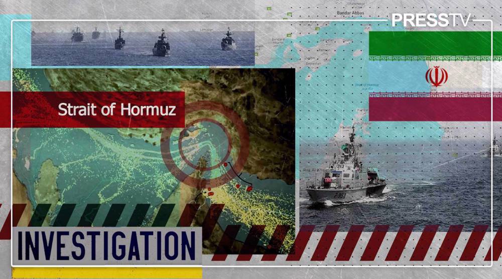
Mountains cannot be bombed flat, and chokepoints cannot be moved. Even the most intensive bombing campaign cannot remove Iran’s ability to threaten the Strait of Hormuz, nor neutralize its scattered missile forces.

Can technology tame the mountains?
It is tempting to think that all of this belongs to the past. Over the last two centuries the railway, the tank, the aircraft and the satellite have each promised to shrink distance and flatten terrain. Perhaps geography is a problem that engineers have already solved.
In most of the world, that may be true. Iran is one of the few places where it is not. A missile may well cross this geography. A fighter jet may well fly over it. But missiles and jets do not hold ground. To seize this land, someone has to put infantry on it, move that infantry through it and keep it supplied there, and that is a task no technology has made possible.
The landings that went nowhere
The record of those who tried is consistent. The Portuguese came ashore at Hormuz in 1507 and held the island from 1515, backed by the most powerful navy of their age. They held islands and fortresses on the coast, and not one step beyond them reached the plateau. In 1622 Shah Abbas expelled them, with the help of English ships.
The British followed. They landed at Kharg and Bushehr in 1838 and again in 1856, during the Anglo-Persian War. Reconnaissance inland showed them an Iranian force at Shiraz, and their commanders judged the expedition too weak to venture toward it. They stayed close to the shore, and when the peace treaty was ratified in 1857 the garrison was ordered home.
Different empires, different centuries, the same result. Foreign forces could take a harbor, and even an island, but they could not make the leap from the coast to the plateau.
Iran is not Iraq
This is where the comparison with Iraq falls apart. In 2003 an invading force could land in the south, cross the open ground around Basra and advance on Baghdad across a flat plain, and once the capital fell, the military structure around it collapsed.
That is the model Washington may carry in its head. It does not exist in Iran.
There is no Basra-to-Baghdad road here. Between the southern coast and the heart of the plateau lie the nested ranges of the Zagros, and the Bushehr-to-Shiraz stretch is only a sample of what follows: coast, plain, mountain, pass, plain, pass again.
Every stage is a separate battle, and none of them ends the war.
Indeed, even if Iran had no army at all, American forces still could not pass through these gorges and reach the center of the plateau. Every mountain, every plain, every pass and every valley that stands in front of them is a defensive front that the people of this land will open against them. Khorramshahr, which held for thirty-four days against Saddam’s armor in 1980, was an early lesson in what that looks like.
The fortress cannot be taken by force
From the Persian Gates in 330 BC to the Zagros foothills in 1982, the pattern has not changed. Invaders have taken cities, crossed plains and sat in Iran’s capital for a time.
They have never managed to hold the plateau. The same crossroads that draws armies to Iran also stretches them out, starves their supply lines and delivers them, exhausted, to the base of the wall. Wars on this land have ended in treaties and borders, not in conquest.
The actors keep changing, from Alexander to Selim to Saddam to Trump. The geography does not, and no new technology has changed what it demands of anyone who wants to conquer it. Iran can be struck from the air, but it cannot be conquered by a military invasion.
 This makes it easy to access the Press TV website