Iran launches three remote sensing satellites on Russian Soyuz rocket
Iran has launched three domestically built remote sensing satellites using a Russian launcher.
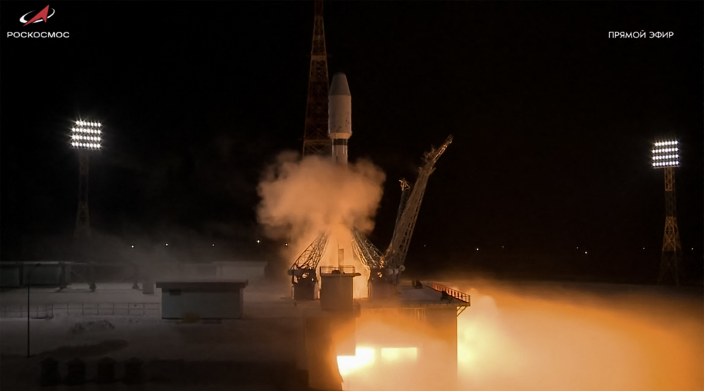
Iranian officials said the three satellites were launched into orbit from Russia’s Vostochny Cosmodrome as part of a multi-payload mission, marking the seventh time the country has used Russian rockets for satellite deployment.
The Soyuz satellite carrier lifted off on Sunday at 16:48 Tehran time, carrying multiple payloads, including Iran’s Zafar 2, Paya, and Kowsar satellites.
🇮🇷🛰️
— Press TV 🔻 (@PressTV) December 28, 2025
Watch the HISTORIC MOMENT when three Iranian satellites were launched into space
Follow https://t.co/B3zXG73Jym pic.twitter.com/DgvcBN9coQ
Iran’s Space Agency chief, Hassan Salarieh, said the launch heralded a bright future for the country’s space sector.
“The successful launch of these satellites, achieved through the participation of various actors in the space industry, reflects the expanding scope of Iran’s space program and the rapid growth of new players in this field," he said.
Salarieh said Iran has long been among the world’s top 10 to 11 countries with full space technology, from building satellites and launch vehicles to having its own systems for launching, controlling, and receiving data.
In remarks ahead of the launch, Iran’s Ambassador to Moscow, Kazem Jalali, described the mission as a major step forward for Iran’s space program.
In a series of posts on the social platform X, Jalali emphasized that the satellites were designed and built entirely with indigenous Iranian technology, the result of collaboration between government agencies, universities, and private knowledge-based companies.
The ambassador explained that while all stages of design and construction were completed in Iran, the launch itself is being carried out in cooperation with Russia.
“Two of the satellites belong to the government, and one belongs to the private sector, and our knowledge-based companies and universities are active in this field.”
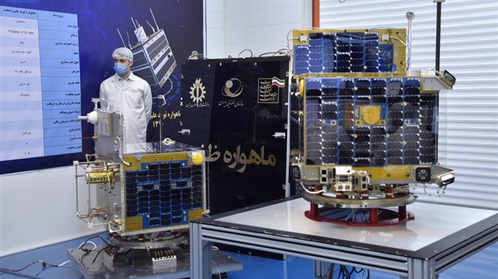
Paya (Tolou‑3), weighing in at 150 kilograms, is Iran’s heaviest satellite to date. It delivers imagery with a resolution of about five meters in black and white and 10 meters in color.
Zafar‑2, developed by the Iran University of Science and Technology, is designed to monitor natural resources, assess environmental conditions, and provide data for disaster response and mapping.
Kowsar‑1.5, an upgraded version of earlier Kowsar and Hodhod satellites, integrates Internet of Things (IoT) capability, enabling real‑time data transmission for smart monitoring systems.
Iran first entered the space arena in 2009 with the launch of the Omid satellite. Despite Western sanctions, Tehran has steadily expanded its civilian space program.

US destruction of Global South convergence symbol in Chabahar

Iran's custodial role in the Strait of Hormuz beyond pipelines

After US policy whiplash, Iran sets the rules in Strait of Hormuz


Four Iranians martyred, five wounded in US missile aggression on Ahvaz
VIDEO | Press TV's news headlines
Protesters rally outside Israeli arms firm Elbit Systems in Bristol, UK
American Tomahawk missile intercepted and destroyed over Kahnuj in Kerman
VIDEO | Minab lays to rest newly-identified remains of victims of US school bombing
US Army turns to older PAC-2 Patriot missiles as war against Iran drains stockpiles
Iran FM warns compromised US officials against mindless aggression
Ops. Nasr-2 and Sa’eqeh: Iran’s retaliatory strikes against US military assets on July 23